In two previous blog postings I described BYU research on using UAV to support Wilderness Search and Rescue and UAV capabilities:
My Research: BYU UAV Demo Dry Run
Robot of the Day: UAVs at BYU
The demo was scheduled at 8:30-11:00 am at Elberta, Utah (in the middle of nowhere), which was about an hour's drive from BYU campus. That meant we had to get there by 8 to set up and test equipments. The previous day's weather forecast predicted snow shower, so I was assigned the task of picking up some hot chocolate from the BYU cafeteria so people don't freeze to death!
Despite the facts that I had to deal with my 10-month old son's high fever at 1:30am and not really fall asleep until 3:30am and unconsciously turned off my alarm clock, I actually made it to the cafeteria only 5 minutes late, then I waited another 25 minutes because they haven't made the hot chocolate yet. By the time I arrived at the demo site at 8:30am, turned out the trailer just got there also, so I didn't miss anything! Also, turned out the weather forecast was way off, there was no snow at all, and it was going to be a great day!


Left to right, top to bottom: 1. BYU Cafeteria 2. Beautiful Utah mountains at Dawn
3. The lonely freeway 4. Driving down the highway 5. Good morning, Cows!
6. Gravel road with the destination in view (the ridge in the far distance).
The pictures above were taken by me using an android phone running NASA's GeoCam mobile client. Therefore, all photos were geo-tagged with GPS locations and camera orientation. You can actually view them from Google Earth, where you'll see the exact route I took on the map. Just download the zip file, unzip, and then double click the kml file.
Viewing pictures from Google Earth
The goal of the demo is to show real search and rescue workers how easy and useful our UAV technologies are in support of search and rescue operations. A simulated search and rescue mission was set up, a member of the search and rescue team had to fly the UAV using our interface and locate the simulated missing person (a dummy placed in the wilderness). Students and professors from BYU also acted as aerial video analysts and ground searchers to assist the simulated search. The picture blow shows a ground searcher scouting around in the distance searching for the missing person. The ground searchers always wear bright-colored vests so they can be easily spotted by others (e.g. from the aerial videos) and don't get shot at by hunters. (I know, research is a dangerous profession!)
After setting up everything, Ron Zeeman, a member of the Utah County Search and Rescue team, test flew the UAV, and completed a test drill (launch, manual control, fixed pattern flying, and landing).
Left to right: 1. People busy setting things up 2. UAV at dawn 3. Last minute exercise
After other Search and Rescue team members arrived, we explained how our UAV works, and then started the simulated search and rescue mission. This time I was quite lucky to catch the flying UAV with my camera.
Left to right: 1. Two more professional searchers arrived 2. Two retired UAVs in display 3. The show is on now!
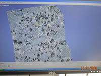
Left to right: 1. The kind of junk people would dump to the middle of nowhere 2. Debris of camp fire 3. Real-time video mosaicing (frame stitching)
Eventually, the missing person was located in the aerial video and confirmed by ground searchers. "Unfortunately", by the time we found "him", he was not breathing.
Technologies demonstrated include auto launch, auto land, various UAV control mode (carrot and stick, fixed pattern flying, etc.), integrated gimballed camera view in augmented virtuality, click and point gimballed camera control (separate from UAV path), real-time video mosaicing, real-time video annotation and video zooming/scrubbing, point of interest communication between video GUI and UAV control GUI.
Technologies not demonstrated but are work in progress include automatic missing person probability distribution generation, automatic path planning (based on distribution), see-ability metric to measure coverage quality, and automatic anomaly detection.
The demo was a great success! The professional searchers were pleasantly surprised by the ease of operating the UAV and the usefulness of the aerial video support. Their comments included, "That was so cool!" "This could be very helpful!"
Video of the Day:
If the UAV sitting in our lab had a mind of its own,
it would have been singing this all night long...
it would have been singing this all night long...


How very cool! How is it not everyone's dream job to play with cool toys for a great cause? Keep up the good work (and the interesting posts; someone actually does read 'em).
ReplyDeleteDefinitely more will be coming. I still have a year's worth to catch up. Thanks for leaving comments. They make my blog posts more alive! So leave more! :)
ReplyDelete